Digitaler Atlas zur Geschichte Europas - interaktive Karte / Digital Atlas on the History of Europe - interactive Map |
||
 |
|
|
Query Result: |
||
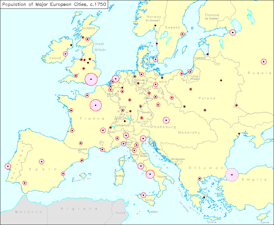
Description:This map contains population data on European cities in 1750. When the cursor is moved to a diagram, the number of inhabitants of the city is displayed under "Query Result". Authors:Andreas Kunz, Monika Krompiec, |
||
Legend: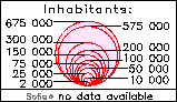
|
||
| © IEG-Mainz/Andreas Kunz | ||